Login
|
Register
Consultation: Grafton Area of Major Change SPD 2017
Home
Consultations archive
Grafton Area of Major Change SPD 2017
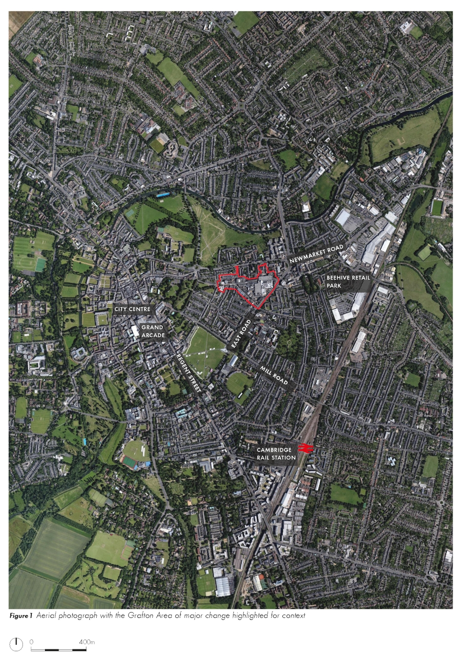
Figure 1 Aerial photograph with the Grafton Area of major change highlighted for context
Search representations
Figure 1 Aerial photograph with the Grafton Area of major change highlighted for context
1. Introduction
1.0 Vision
1.1 Background
1.2 Purpose, Scope and Status
1.3 Structure
1.4 Planning Policy Context
Figure 4 Legal & General Property land ownership within the SPD area
2. Site and Context
2.1 Site Location
Land ownership
2.2 Movement and Access
Streets
Parking
Public transport
Cycle routes and parking
Site access
2.3 Land use
Existing land uses
Figure 9 Existing ground floor land uses
The changing face of the retail environment
Retail need
Frontage
2.4 Scale and massing and built form
Existing building heights
Historic development
2.4.6
Conservation Areas
Buildings
Buildings of Local Interest
Positive and negative buildings
Views and landmarks
2.5 Landscape and public realm
Pedestrian movement and public realm
Open space
Trees and landscape
2.6 Public consultation
Stakeholder Workshop 1
Stakeholder Workshop 2
Figure 28 Photographs from workshop 2 (April 2017)
Figure 29 Exhibition at the Grafton (May 2017)
Exhibition - The Grafton Centre
2.7 Summary of opportunities and constraints
Issues
Opportunities
3. Key Objectives
3.1 Vision
3.2 Objectives
1. Integration and permeability through better streets and spaces
2. A balanced and successful destination
3. Flexibility and phasing
4. Strategies For Change
4.1 Overview
4.2 Movement and access
Long-term east-west connection
Improvements to north-south connections
Vehicle access, routes and hierarchy
Public transport
Servicing
Car parking - public / retail parking
Car parking - residential and office uses
Cycle Parking
4.3 Land use
Retail, leisure, food and drink
Residential uses
Student housing
Office uses
Community and other uses
A flexible framework
4.4 Scale, massing and built form
i) New development sites along key routes
ii) Infill development opportunities
iii) Selective redevelopment of less sensitive buildings
iv) Shopfront improvements
v) Additional space within the Grafton Centre
Building heights
Views
Heritage
Fitzroy Street
East Road
Burleigh Street
4.5 Landscape, environment and public realm
Key spaces
Fitzroy Street and Burleigh Street
East Road
Access to strategic open space
Environmental considerations and sustainability
Site-wide sustainability
Surface water and foul drainage
Ecology
Environmental health
4.6 Delivery and phasing
Planning obligations
Indicative planning obligations schedule
Appendix A: Glossary of Terms
Appendix B: Relevant Local Plan references
Appendix C: List of Figures
Figure 1 Aerial photograph with the Grafton Area of major change highlighted for context
Next Page >>
For instructions on how to use the system and make comments, please see our
help guide
.
back to top
back to top
Powered by
Site map
|
Accessibility
|
Privacy
|
Cookies